Preikestolen (Pulpit Rock) hike guide: how to get there from Bergen
Stavanger: Preikestolen (Pulpit Rock) Guided Hike
Can you do Preikestolen as a day trip from Bergen?
Yes, but it is a long day. Bergen to the Preikestolen trailhead takes 4–5 hours by express boat to Stavanger plus bus. The hike is 8 km round trip (about 4 hours). Total day: 12–14 hours. An overnight in Stavanger makes for a more relaxed experience. Guided day tours from Bergen manage the transport logistics.
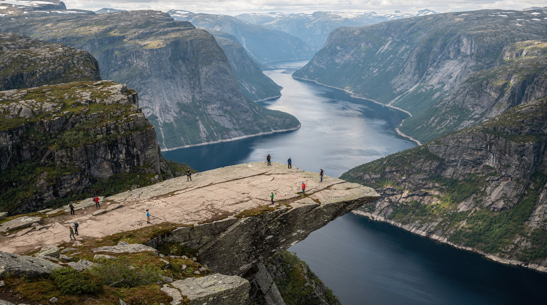
Preikestolen — the Pulpit Rock — is a near-horizontal rock platform jutting from a cliff 604 m above Lysefjord. The view from the top is among the most dramatic in Norway, and unlike Trolltunga, the hike to reach it is accessible to most moderately fit adults. This makes it arguably the most popular hiking destination in the country — and the crowds in July reflect that.
| Where | Preikestolen Fjellstue, ~40 km from Stavanger |
| Cost | Free trail; express boat + bus around NOK 400–600 each way |
| Time needed | 3.5–5 hours hiking; 12–14 hours as a Bergen day trip |
| Getting there | Express boat Bergen–Stavanger, then bus to the trailhead |
| Best time | May–October self-guided; early morning to beat crowds/parking |
If you are still shaping the wider trip, the Bergen first-timer guide and the best day trips from Bergen put this hike in context next to the easier options, and the fjord viewpoints roundup shows what else is on offer if you decide the transit is too much.
What Preikestolen actually is
The platform is a natural geological formation — a flat rectangular block of gneiss approximately 25 x 25 m, separated from the main cliff by a joint crack. The view from the edge looks straight down 604 m to the Lysefjord below and across the fjord to the opposite ridge. Eagles are regularly seen at this altitude.
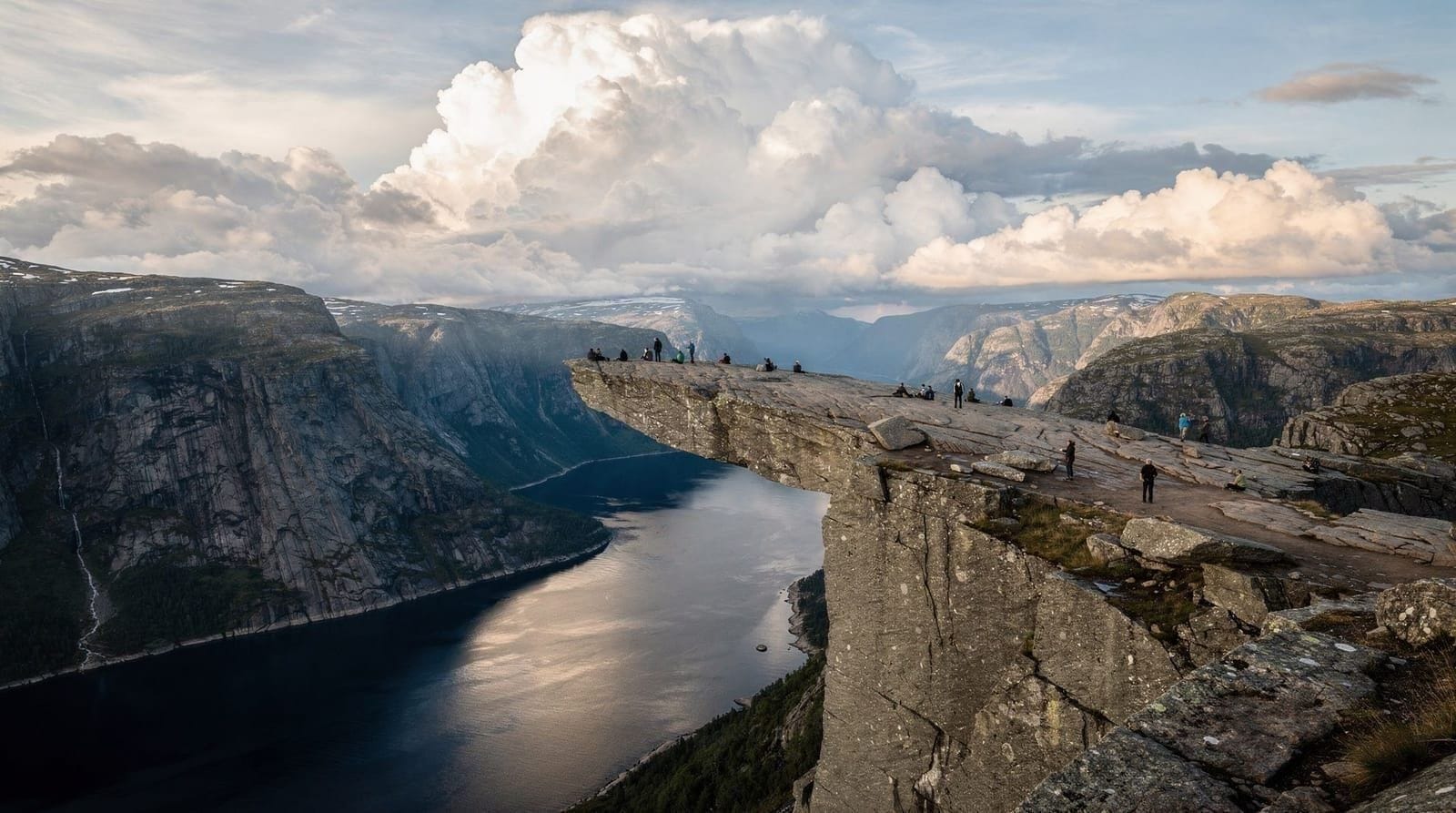
Unlike Trolltunga, where the visual drama is the horizontal tongue extending over the void, Preikestolen presents as a platform — a wide, flat area that can accommodate many people simultaneously. This is both its appeal and its challenge in peak season: the plateau can feel crowded when 500 hikers are present.
The trail from Preikestolen Fjellstue
The trailhead is at Preikestolen Fjellstue (lodge), approximately 40 km from Stavanger. The route is well-marked with red Ts (the Norwegian Trekking Association marking system). The one-way distance is approximately 3.8 km with 500 m elevation gain.
Section 1 (Fjellstue → first plateau, 45–60 minutes): The trail begins with sustained elevation gain through birch forest and rocky steps. This is the hardest physical section — it does not ease up until you reach the first plateau.
Section 2 (plateau → Preikestolen, 30–40 minutes): After the initial climb, the trail levels across a mountain plateau with views opening in multiple directions. Smaller lakes appear. The final approach to the platform involves some scrambling on exposed rock — use hands for balance, not a technical climb.
At the top: The platform is as advertised. The floor drops away abruptly at the northwest corner where most photographs are taken. The main ledge section is solid rock with no loose material. Do not sit or stand with your legs dangling over the edge — this has resulted in serious accidents.
Return: Allow slightly less time descending than ascending, but do not rush the rocky sections on descent — this is when slips happen on tired legs.
Getting there from Bergen
Bergen to Preikestolen is a 4–5 hour journey each way. This is why most visitors who do it as a day trip describe it as exhausting. An overnight in Stavanger is the comfortable alternative.
By express boat + bus:
- Bergen → Stavanger by express boat: 2.5 hours (Fjord Line or Norled ferries from Strandkaiterminalen). Price: approximately NOK 400–600 per person.
- Stavanger → Preikestolen Fjellstue by Tide/Kolumbus bus: approximately 1 hour, with a connection at Tau ferry crossing (included in the bus ticket). Departs Fiskepiren bus terminal in Stavanger.
- Total: approximately 4–4.5 hours each way.
By car (Bergen → Stavanger → trailhead):
The E39 south from Bergen reaches Stavanger in about 3 hours, though the route involves several ferry crossings (most are replaced by tunnel now) and the Ryfast undersea tunnel (opened 2020) bypasses the main Stavanger → Tau ferry. From Stavanger city, the trailhead is approximately 40 km and 50 minutes via Forsand.
Guided tour from Bergen:
Guided tours handling transport logistics depart Bergen early morning (typically 5–6 am) and return by late evening. These cost approximately NOK 1,400–1,800 and eliminate the need to coordinate express boats, buses, and return timing.
Stavanger: Preikestolen (Pulpit Rock) Guided HikeThe route to Preikestolen is four hours return over rock that becomes genuinely awkward in wet weather, and the ferry-and-bus connection from Stavanger has to be caught in both directions: a guided Preikestolen hike from Stavanger handles the transport and the conditions together.
Whichever route you pick, check the getting to Bergen and getting around Bergen guides for how to reach the departure terminal, and keep the Bergen travel budget in mind: the transport is the real cost of this hike, not the trail.
Stavanger as a base
Staying overnight in Stavanger makes the Preikestolen day significantly more relaxed. You take the express boat from Bergen in the afternoon, spend an evening in Stavanger (a small, walkable city with a good restaurant scene — Stavanger is Norway’s oil capital but also has strong food culture), then drive or take the morning bus to Preikestolen, arriving before the crowds peak.
Stavanger also offers its own attractions: the old wooden warehouse district (Gamle Stavanger), Norwegian Petroleum Museum, and the Stavanger Cathedral. For adventurous hikers, Kjeragbolten — a boulder wedged in a cliff crevice over Lysefjord — is a harder alternative to Preikestolen accessible from the same base.
Season and guide requirements
May – October (standard season): Self-guided hiking is permitted. The snow-free season at Preikestolen’s lower elevation (604 m vs. Trolltunga’s 1,100+ m) typically starts earlier in May. The trail is well-maintained; no technical equipment needed in dry summer conditions.
November – April (off-season): Ice and snow make the exposed sections dangerous. A licensed mountain guide and crampons are required. Winter Preikestolen guided hikes are available and offer a completely different, less-crowded experience — the platform in snow is spectacular.
Stavanger: Preikestolen (Pulpit Rock) Hike with Local GuideBecause the weather decides so much here, read what to pack for Bergen before you go, and the best time to visit Bergen if your dates are still flexible.
Comparing Preikestolen and Trolltunga
| Preikestolen | Trolltunga | |
|---|---|---|
| Distance (round trip) | ~8 km | 20–28 km |
| Elevation gain | ~500 m | 700–1,200 m |
| Time (round trip) | 3.5–5 hours | 10–14 hours |
| Difficulty | Moderate | Demanding |
| Height above fjord | 604 m | 700 m |
| Self-guided season | May–Oct | Jun–Sep |
| From Bergen (travel) | 4–5 hours | 3–3.5 hours by car |
| Crowds (July) | Very high | High |
The practical conclusion: Preikestolen is more accessible, better for families with older children, and more realistic as a day trip. Trolltunga delivers more extreme scenery and a more demanding physical experience. Both are worth doing if you have separate days for each; if forced to choose one, Preikestolen is the default for most visitors.
Viewing Preikestolen from the Lysefjord
If hiking is not an option, the view from the fjord looking up at Preikestolen is equally impressive — possibly more so, as you appreciate the full 604 m height in a way you cannot from the top. The Lysefjord cruise from Stavanger (2.5–4 hours, approximately NOK 450–650 per adult) passes directly below Pulpit Rock.
This is a legitimate alternative for visitors with mobility limitations, families with young children, or anyone for whom the hike is not feasible. It is also worth doing in addition to the hike if you are based in Stavanger — the two perspectives together give a complete understanding of the site.
Practical preparation
What to bring: Same fundamentals as any mountain day hike — waterproof jacket and trousers, layered clothing (summit is exposed and cool even in summer), hiking boots with grip, 2 litres of water, food for the day (no services on the trail after the Fjellstue cafe), navigation, and phone with Ut.no or Maps.me GPS.
Early start: In July and August, arrive at the Fjellstue parking area by 7 am at the latest. Parking (NOK 250/day) fills by 8 am on summer weekends and you will waste an hour finding alternatives and walking from unofficial parking. The trail is also significantly less crowded for the first hour of light.
Dogs: Permitted on the trail but must be on a lead near the cliff edge. Some sections require dogs to be carried or assisted.
Children: The Preikestolen trail is suitable for children aged 10+ who hike regularly. The exposed sections near the summit require adult supervision. Young children (under 8) are not recommended above the first plateau — the rock scrambling and cliff exposure are not appropriate for that age group.
If a long transit day does not appeal, the fjord cruises from Bergen and the Nærøyfjord cruise give you fjord scenery without leaving the Bergen area, and the Bergen in 2 days itinerary shows how to fill the time instead.
Should you day-trip it or stay overnight?
The honest trade-off, laid out directly:
| Bergen day trip | Stavanger overnight | |
|---|---|---|
| Total time commitment | 12–14 hours, one long day | 2 days, more relaxed pace |
| Crowd level on trail | Whatever time you arrive | Can start before 7 am, ahead of peak crowds |
| Extra cost | None beyond transport | 1 hotel night (NOK 1,200–2,000) |
| Fatigue | High — a genuinely long day | Low — proper rest before and after |
| Flexibility if weather is poor | None — you are committed to the day | Can shift the hike to the next morning |
For most travelers with the extra night to spare, the Stavanger overnight is the better experience — not because the day trip does not work, but because arriving tired at both the trailhead and the return boat undercuts the payoff. If your itinerary genuinely cannot accommodate an extra night, the day trip is still a legitimate way to see Preikestolen; just start as early as the first express boat allows.
Connecting Preikestolen to your Bergen trip
The Lysefjord destination page covers the fjord area in full, including the Kjeragbolten option for more experienced hikers. For comparison with Bergen’s own mountains, the hiking around Bergen guide covers Fløyen, Ulriken, and the 7-mountain circuit. The Trolltunga guide is the companion read for anyone planning Norway’s other iconic hike.
For multi-day itinerary planning, the Bergen and fjords 5-day itinerary includes a Stavanger/Preikestolen day alongside the Bergen fjord experiences.
Frequently asked questions about the Preikestolen hike
Do I need to book a Preikestolen hike in advance?
The trail is free and requires no reservation. However, guided tours from Bergen and Stavanger fill up in peak summer — book those 2–4 weeks ahead. The shuttle bus from Stavanger to the trailhead may require advance booking on busy weekends; check Kolumbus/Tide websites.
Is there accommodation at Preikestolen?
Preikestolen Fjellstue is a mountain lodge at the trailhead with accommodation (dormitories and private rooms) and a cafe. Booking in summer is necessary; contact directly via their website.
How high is Preikestolen?
The plateau is 604 m above the Lysefjord surface below. The trailhead (Fjellstue) is at approximately 270 m above sea level, meaning the elevation gain from trailhead is about 334 m (not 604 m — the fjord is the reference point for the famous height, not the trailhead).
Is the Preikestolen rock stable?
Geologically, yes. The cliff is solid gneiss bedrock that has been studied; no imminent collapse is expected. The joint crack behind the platform is well-known and stable on human timescales. The Norwegian Trekking Association monitors the area and would close access if there were safety concerns.
Can I drive to the Preikestolen trailhead?
Yes, via Forsand from Stavanger. The trailhead parking is at Preikestolen Fjellstue. In summer, arrive before 7 am to guarantee a parking space (NOK 250/day). Without a car, the bus from Stavanger (with the Tau ferry connection) is the standard public transport option.
Is there a trail map available?
The Norwegian Trekking Association (DNT) publishes maps. The Ut.no app (free, Norwegian language) has GPS tracks for all major Norwegian trails including Preikestolen. Download the offline map before starting — mobile signal can be intermittent at altitude.
What happens if I cannot finish the hike?
Turn back without shame. The trail is not a loop — you retrace your steps. If you reach the plateau and the final rocky section feels beyond your ability or confidence, the views from the plateau are themselves excellent and there is no obligation to reach the very edge.
Is there a winter version of the Preikestolen hike?
Yes — winter guided hikes are available. The platform in snow is strikingly beautiful and attendance is a fraction of peak summer. Crampons and a guide are required. The Stavanger-based operators run winter hike programs from November through March.
Is Preikestolen or Trolltunga the better choice if I can only do one?
For most visitors, Preikestolen is the more sensible choice — shorter, less physically demanding, and more accessible from Bergen despite the longer transit. Choose Trolltunga instead only if you specifically want the more extreme physical challenge and can commit to an overnight near Odda; the comparison table earlier in this guide covers the full trade-offs.
Top experiences
Bookable activities with verified prices and instant confirmation on GetYourGuide.