Best fjord viewpoints in Western Norway — 10 spots worth the effort
The fjord viewpoints of Western Norway range from a 5-minute walk from a car park to a 6-hour return hike. The best ones share a common characteristic: they give you the full scale of what a fjord actually is — not a pretty bay, but a trench cut through mountains by glaciers, with walls that rise hundreds or thousands of meters from the water and extend for kilometers in each direction.
This list covers viewpoints accessible from Bergen and the surrounding region, with honest access notes — including which ones have become so crowded that the experience suffers and which ones remain genuinely rewarding.
| Easiest | Fløyen (funicular) and Dalsnibba (car) |
| Hardest | Kjeragbolten (10 km, ~5 hrs, exposed sections) |
| Season | Most mountain viewpoints: May–October only |
| Cost range | Free (Fløyen trail, Ørneveien) to NOK 250 (parking/tickets) |
| Least crowded | Vøringsfossen, Ulriken–Fløyen ridge |
1. Stegastein viewpoint, Nærøyfjord — the iconic platform
Stegastein is a cantilevered wooden viewing platform extending 30 meters out over the Aurlandsfjord at 650 meters altitude. It sits above Aurland village on National Scenic Route 243 and is the most photographed fjord viewpoint in Norway after Trolltunga.
What you see: The Aurlandsfjord (an arm of Sognefjord) stretching south, the tiny white houses of Flåm village at the water’s edge, and the sheer fjord walls. The platform itself is architecturally distinctive — minimal, elegant, and apparently floating above the void.
Access: By car from Aurland (15 minutes, steep road, open May–Oct) or as part of a tour from Flåm. Tour options leave from Flåm and include Stegastein in a half-day circuit. See Flåm viewpoint and Stegastein tour.
Book the Stegastein viewpoint excursion from FlåmCrowds: Heavy in July and August (9 am–3 pm). Best before 8:30 am or after 5 pm. Off-season (May, September): significantly quieter.
Honest note: The platform itself is slightly smaller than photographs suggest (roughly 30 meters long, 5 wide). It will be crowded in peak season. The view is genuine and the drop below is real. Worth doing despite the crowds.
Hellesylt sits at the far end of the Geirangerfjord and is where the road west resumes, so a one-way sailing that ends there turns a return trip into a through route: a Geiranger Fjord tour with a stop in Hellesylt works for anyone continuing rather than doubling back.
2. Dalsnibba (Geirangerfjord) — the aerial view
Dalsnibba is a mountain summit accessible by the Nibbevegen toll road (NOK 210 per car), rising to 1,476 meters above Geiranger. From the viewpoint, the entire Geirangerfjord is visible as a narrow blue snake threading through the mountain landscape — an aerial perspective that no other accessible point in Western Norway matches.
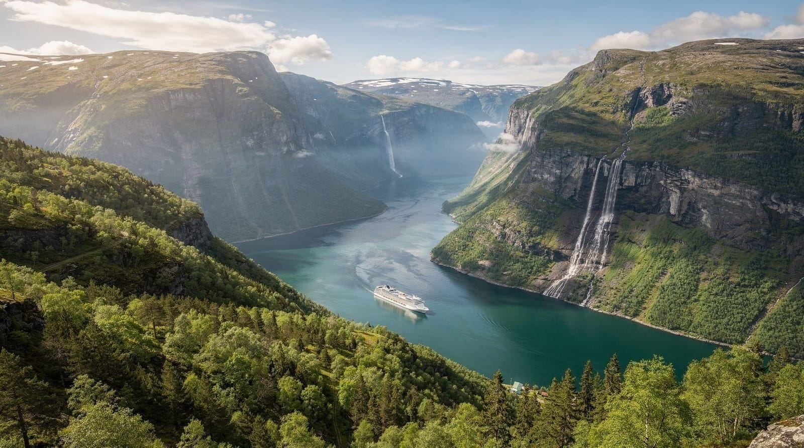
What you see: Geiranger village at the base of the fjord (barely visible as dots from this height), the Seven Sisters waterfall directly across the valley, the mountain terrain that encircles the fjord, and — on clear days — a 360-degree panorama extending toward Åndalsnes and the coast.
Access: Drive from Geiranger on Rv63 (the Ørneveien/Eagle Road) then turn onto the Nibbevegen road. 20 minutes from Geiranger by car. Road open May–October only (heavy snow closes it in winter).
Honest note: At 1,476 meters, Dalsnibba is above the cloud layer on many summer days. If Bergen is cloudy, Dalsnibba may be above cloud or in cloud — check the forecast on mountain-specific weather services (yr.no) before committing the NOK 210 toll. On a clear day, it is the finest elevated fjord view in Norway. On a cloud day, you see white.
3. Preikestolen (Pulpit Rock) — the famous ledge
Preikestolen is a 604-meter vertical cliff above Lysefjord with a flat, roughly 25×25 meter rock platform on top. The photograph of people sitting on the edge with the fjord 604 meters below is one of the most reproduced images in Scandinavian tourism.
What you see: Lysefjord extending into the distance, 42 km of narrow fjord visible from the top, the vertical drop below (do not look down unless you are comfortable with heights), and Kjerag mountain opposite.
Access: 4-hour return hike (8 km, 500m elevation gain, moderate difficulty). Trailhead from Preikestolen Fjellstue lodge (1 hour from Stavanger by car and ferry). No car? Express boat from Stavanger to the trailhead area. See Preikestolen guided hike tour.
Season: May–October. Guide required November–April (snow and ice). Parking: NOK 250.
Honest note: Preikestolen has become one of Norway’s most visited attractions. In peak July, the summit can have 3,000+ visitors simultaneously. The platform itself is overcrowded; you may need to wait to stand at the famous edge. The hike is genuinely beautiful regardless; the view is outstanding. Time your visit for early morning (7 am start) to beat the afternoon crowds.
4. Ørneveien (Eagle Road) above Geiranger — 11 hairpin bends
Ørneveien is the mountain road climbing from Geiranger to the south on Rv63 — 11 hairpin switchbacks rising 750 meters above the fjord. Designed as a National Scenic Route, it is as much about the driving experience as the view, but the perspective looking back down at Geiranger and the fjord from the upper hairpins is genuinely dramatic.
Access: Drive or take a local bus from Geiranger. The road is open May–October. Multiple stopping points on the way up — pull over safely at the marked viewpoints.
Best viewpoint: The bend at approximately 400 meters, looking directly back down at Geiranger and the Geirangerfjord opening to the north. This composition — hairpin road in the foreground, fjord below, mountains above — is among Norway’s most photographed road scenes.
5. Vøringsfossen viewing platform — above Norway’s highest free fall
The Vøringsfossen waterfall in Eidfjord (Hardangerfjord area) drops 182 meters in free fall — one of the highest waterfalls in Norway. A new viewing platform opened in 2021 directly above the main drop, allowing visitors to stand at the cliff edge and look down into the Måbødalen gorge.
What you see: The full 182-meter drop of the main fall, the gorge walls, and the secondary falls visible from different angles along the cliff path. The spray creates a persistent mist cloud visible from a distance.
Access: 2.5–3 hours from Bergen by car via Voss and the Rv7/Rv13. From the car park (NOK 100), it is a 10-minute walk to the main platform. Also accessible from Eidfjord by local bus on certain days — check Skyss timetables.
Honest note: The waterfall is at its most powerful in May–June during snowmelt. By August, flow is reduced. The platform is excellent architecture — it does not feel gimmicky but rather uses the landscape intelligently.
6. Stalheim Hotel viewpoint — the Nærøy valley
Stalheim Hotel sits on a cliff edge above the Nærøy valley at 500 meters altitude. The view from the hotel terrace — accessible to non-guests who come for coffee or lunch — shows the Nærøy valley in full: a U-shaped glacial valley with flat green floor between sheer walls, the Stalheimsfossen and Sivlefossen waterfalls visible from the terrace, and the valley road winding down into the floor below.
Access: Drive from Voss on Rv13 (30 minutes), or take the Stalheimskleiva road which the Gudvangen–Voss bus (part of the Norway in a Nutshell circuit) uses. Reachable by bus as a stop on the nutshell route.
The honest problem: Stalheim Hotel is a historic grand hotel in a spectacular location, but the prices for food and drink reflect both. Coffee and waffles on the terrace: approximately NOK 140–180. Worth stopping for the view; you do not need to eat.
7. Fløyen and Ulriken ridge — Bergen’s own viewpoints
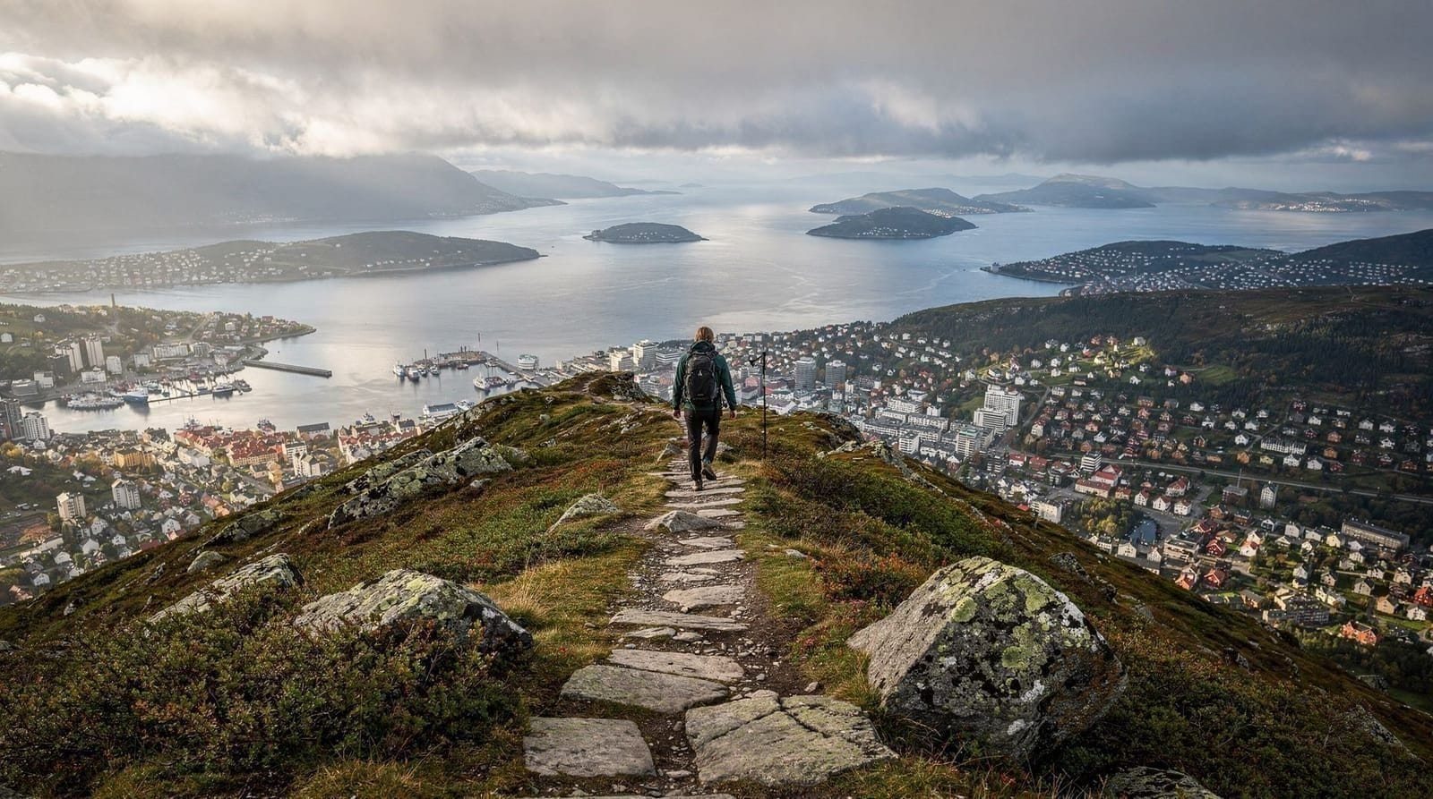
Bergen’s local mountain ridge provides continuous fjord views available year-round without leaving the city area. The Fløibanen funicular to Fløyen (320 m) and the Ulriksbanen cable car to Ulriken (643 m) both provide aerial city and fjord perspectives.
Fløyen: City panorama, Osterfjord visible to the north, best for Bergen city photography. Return ticket (current price at floibanen.no). See Fløibanen guide.
Ulriken: Higher, wider view, ocean to the west, stronger sense of Bergen’s position in the fjord landscape. Return NOK 249. The ridge between Ulriken and Fløyen (2 hours’ hike) gives continuous 360-degree views and is often empty of crowds.
8. Kjeragbolten area, Lysefjord — exposed but extraordinary
Kjeragbolten is a boulder wedged in a cliff crevice 1,110 meters above Lysefjord. The famous photograph — a person standing on the boulder with nothing beneath them — is real; you can actually stand on it (most choose to crouch or sit). The hike to get there is harder than Preikestolen: 10 km round trip, approximately 5 hours, with significant elevation change and some exposed scrambling sections.
What you see: Lysefjord from 1,110 meters — the most dramatic elevated fjord view accessible without technical climbing equipment in Norway. Also the Kjerag plateau, a high-mountain environment above the treeline.
Access: Trailhead at Øygardstøl (40 km from Stavanger, ~4 hours from Bergen). Season: May–October only. Same Stavanger/Lysefjord area as Preikestolen but further and more demanding.
Honest note: This is for confident hikers only. The route includes steep and exposed sections where falling would be serious. Do not attempt in wet conditions or if you are not comfortable with heights on uneven terrain. Children below 10 are not recommended.
9. Trollstigen national visitor centre — the hairpin road view
Trollstigen is a National Scenic Route road with 11 hairpin bends climbing 858 meters. The National Visitor Centre at the top offers a viewing bridge extending out over the main Stigfossen waterfall (320 m) and the hairpin road below. The perspective from the bridge — looking down at the switchbacks with the fjord valley beyond — is among Norway’s most dramatic road-engineering views.
Access: On the road between Geiranger and Åndalsnes (Rv63). Part of the western Norway driving route described in the 7-day Western Norway itinerary. Open May–October.
Facilities: Large visitor centre at the top (café, toilets, good exhibits on the road’s history and ecosystem). The car park is free but fills by 10 am in peak season.
10. Nærøyfjord from the water — the moving viewpoint
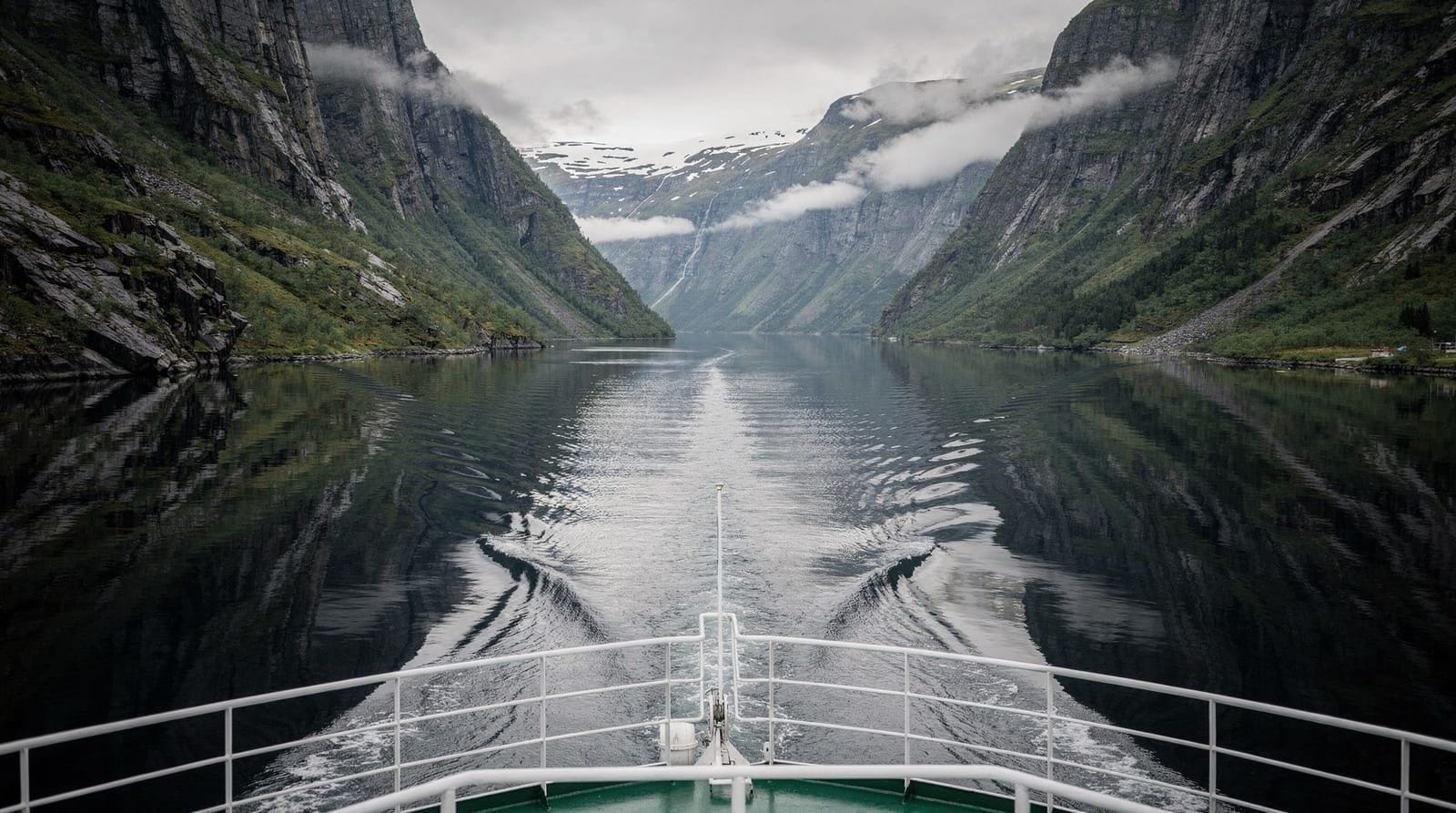
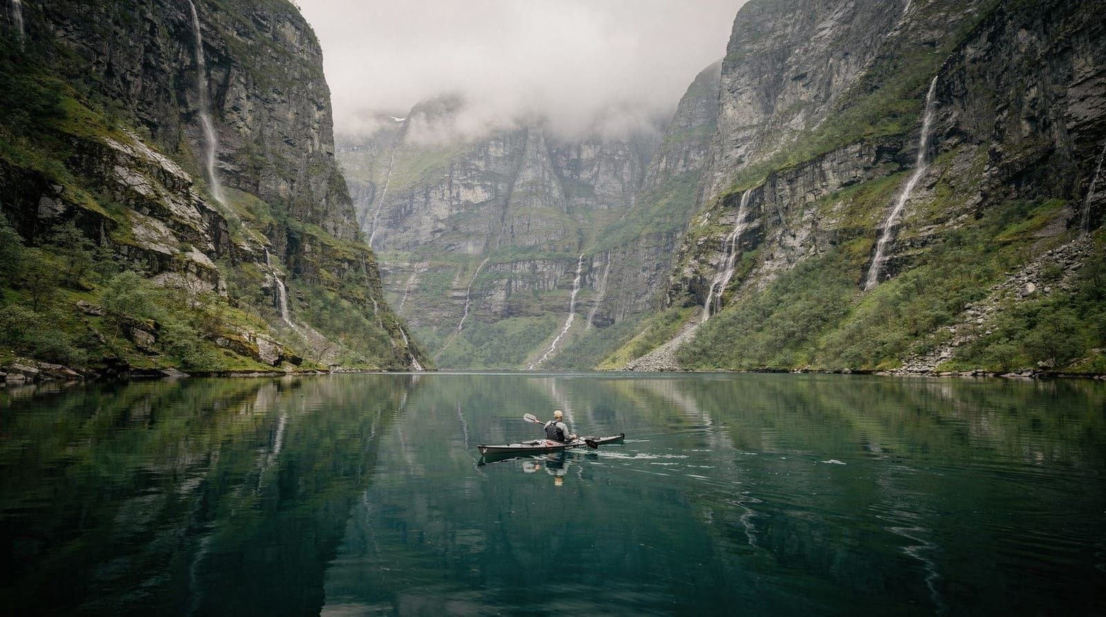
The 2-hour electric cruise through Nærøyfjord from Flåm to Gudvangen (or reverse) is itself one of the finest “viewpoints” in Western Norway — not static, but a continuous panorama as the boat moves through the 250-meter-wide channel with 1,400-meter walls on both sides.
From the deck, you see things impossible from any road: the clifftop farms of Styvi and Bakka (still in occasional use, accessible only by boat), the waterfalls from the valley snowmelt, and the changing angle of the fjord walls as the boat turns through each bend.
Book the Nærøyfjord cruise from BergenSeason: May–September, with full timetable June–August. See Nærøyfjord cruise guide for departure times and how to book independently versus through Fjord Tours.
Which viewpoint fits your effort level and time budget
| Viewpoint | Effort | Time from Bergen | Crowds |
|---|---|---|---|
| Fløyen / Ulriken | Funicular / cable car | 10–15 min in city | Heavy midday, quiet early/late |
| Stegastein | Short drive or tour | ~2.5 hrs | Heavy July–Aug |
| Dalsnibba | Toll road drive | ~4–5 hrs | Moderate, weather-dependent |
| Vøringsfossen | Car + 10-min walk | ~2.5–3 hrs | Light |
| Preikestolen | 4-hr return hike | ~4 hrs (via Stavanger) | Very heavy in peak season |
| Kjeragbolten | 5-hr return hike, exposed | ~4 hrs (via Stavanger) | Moderate — self-selecting by difficulty |
| Nærøyfjord (boat) | None — scenic cruise | ~2–3 hrs to Flåm | Moderate |
If you only have time for one, choose based on effort tolerance: Fløyen or Ulriken for a no-planning city option, Stegastein or the Nærøyfjord cruise for the classic fjord-arm view with moderate travel, and Preikestolen or Kjeragbolten only if you specifically want a hiking day. The 7-day Western Norway itinerary sequences several of these realistically rather than trying to cram them into one trip.
Combining viewpoints with a fjord cruise
Several of these viewpoints work best paired with a cruise rather than visited standalone. Stegastein pairs naturally with a Flåm-based Nærøyfjord circuit; Vøringsfossen pairs with a Hardangerfjord cruise day; and the Fløyen–Ulriken ridge pairs with any Mostraumen or Nærøyfjord departure from Bergen harbor, since both mountains are visible on the walk to the pier. Treating a viewpoint as an add-on to a booked cruise, rather than a separate outing, is usually the more time-efficient way to see Western Norway on a limited schedule.
Frequently asked questions about fjord viewpoints in Western Norway
What is the most accessible fjord viewpoint near Bergen?
Fløyen (reached by the Fløibanen funicular in 6 minutes from central Bergen) is the most accessible. Stegastein requires a 2-hour train journey to Flåm plus car or tour. For a full fjord-wall experience without travel, the Mostraumen cruise from Bergen harbor is the most accessible boat-based option.
Is Trolltunga a fjord viewpoint?
Trolltunga is a rock ledge hanging 700 meters above Lake Ringedalsvatnet — technically a lake view, not a fjord view. The lake is connected to the Hardangerfjord system but the viewpoint itself overlooks a glacially formed lake rather than the main fjord arm. Still an extraordinary sight, but categorically different from the fjord-wall perspectives listed above.
Which viewpoint is best for a photograph?
Stegastein for the “platform floating above the fjord” shot. Dalsnibba for an aerial fjord perspective. Preikestolen for the iconic ledge drop. Nærøyfjord boat deck for reflection shots of fjord walls.
Are any viewpoints accessible in winter?
Bergen’s Fløyen and Ulriken are year-round. Bergenhus Fortress grounds are always open. Most mountain viewpoints (Stegastein, Dalsnibba, Trollstigen, Ørneveien) close October–May due to snow. Check road status on vegvesen.no before any mountain road in October or April.
How do I visit Geirangerfjord viewpoints from Bergen?
Geiranger is 4–5 hours from Bergen by car (via ferries) or 3 hours from Ålesund. It is not practical as a single-day Bergen day trip. See the 7-day Western Norway itinerary for a realistic multi-day route incorporating Geiranger. One-day approach: fly Bergen–Ålesund (~1 hour), drive to Geiranger (1.5 hours), return.
Are the viewpoints suitable for visitors with limited mobility?
Stegastein: paved path from car park (some gradient). Dalsnibba: car park to viewpoint is flat, short walk. Fløyen: funicular access, flat paths near the top. Preikestolen, Kjeragbolten, Trolltunga: not accessible without significant mobility and hiking ability. Ørneveien: road-based, accessible from a car. Nærøyfjord cruise: fully accessible by boat.
Can I see multiple viewpoints in one day from Bergen?
Fløyen and Ulriken can both be done in a single morning, since they are within the city and 2 hours apart via the ridge trail or a short bus ride. Combining a distant viewpoint like Stegastein or Vøringsfossen with a Bergen-based one in the same day is not realistic — each requires several hours of travel each way. Plan one distant viewpoint per day, or build them into a multi-day route like the 7-day Western Norway itinerary.
Do I need a car for these viewpoints, or can I use public transport and tours?
Fløyen, Ulriken, and the Nærøyfjord boat viewpoint are all reachable without a car (funicular, cable car, train, and boat respectively). Stegastein, Dalsnibba, Vøringsfossen, and Trollstigen are far easier with a car, though guided tours from Bergen or Flåm cover several of them for travelers without one. Hiking around Bergen covers trailhead access for the walk-in options.